Site Contents
Maps of London
The City
London Boroughs
Sitemap
|
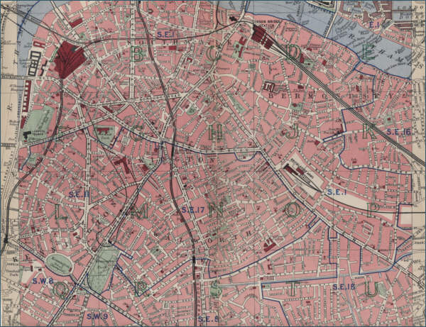
Old Map of Lambeth, London
The map below shows Lambeth, situated in south London,
and the surrounding area as it was around 1940. The map also shows
Southwark, Bermondsey, Kennington, Walworth and Newington. Click on the
map to view a larger scale map showing the street plan and the extent of
the built up area at the time. Nine large scale maps are accessible by
clicking on a selected area of the map.
|
 |