Site Contents
Home
The City
London Boroughs
Sitemap
|
City of London Maps
The City of London functions as
a small city within Greater London. It is not strictly speaking
a London borough but has its own governing corporation, which
performs similar functions to the councils of the other London
boroughs. The cities of London and Westminster lie at the heart
of the modern city, which has grown around them since the Middle
Ages. The City of London, often referred to as simply "the
City" has become one of the world's major financial centres,
rivalling Wall Street in importance. Although covering only one
square mile in area, and with a small resident population of
around ten thousand, its population swells during office hours
to around three hundred thousand with the influx of commuters.
The maps below shows the city of London as shown on the
Bartholomew maps of the early part of last century. |
 |
|
|
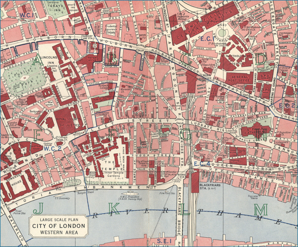
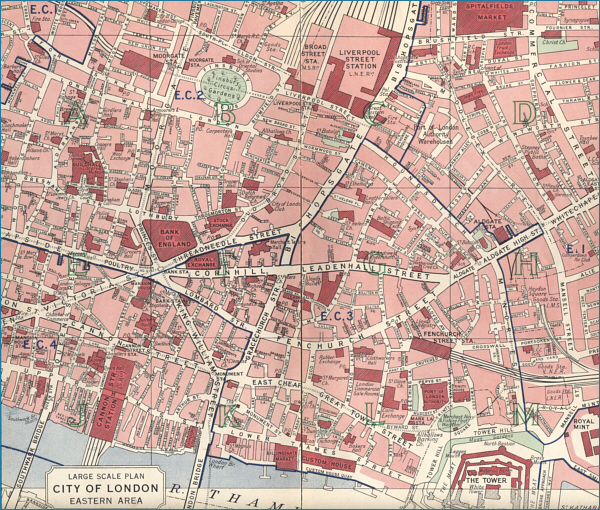
Old Maps of the City of London
Below are two maps showing the eastern and western
parts of the City of London as it was pre 1940. Although much
has changed since that time, many of the streets and major buildings
remain unchanged. Click on any part of a map to view a large scale plan
of that part of the City. The City of London has been divided into
thirty two large scale maps, sixteen for each of the maps below, all
accessible by clicking on a selected area of your chosen map.
City of London - West
Click on a selected area of the map to enlarge
The maps
on this website have been reproduced with the permission of
Collins Bartholomew
|